
Enjoy the sunshine today and the mild temperatures tomorrow, because winter is about to make a loud comeback.
Meteorologists are tracking a complex coastal storm system that threatens to slam the Delaware Valley later this week, potentially turning the Friday morning commute into a nightmare. While the exact track is still finalizing, one thing is clear: Thursday night into Friday morning will be messy.
The Timeline
- Monday & Tuesday: We start the week on a calm note. Monday is blustery but bright, and Tuesday will feel almost spring-like with highs approaching 50 degrees.
- Wednesday: The transition begins. Expect clouds to thicken and rain showers to develop late in the day as the system approaches from the south.
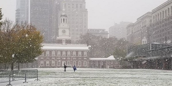
- Thursday (The Main Event): Rain becomes widespread during the day. As temperatures plummet Thursday night, that rain is expected to change over to a wintry mix or wet snow, particularly after sunset.
- Friday Morning: This is the danger zone. Any standing water or slush could freeze flash-freeze as temps dip into the 20s, creating black ice conditions for the morning drive.
The “Rain-Snow Line” Battle
The biggest question mark remains the dreaded I-95 corridor rain-snow line.
- City & South Jersey: Currently, it looks like a mostly rain event that ends with a coating of slushy snow.
- Suburbs (Montco/Bucks/Chester): Residents north and west of the city have a significantly higher chance of seeing accumulating snow (1-3 inches possible) as the cold air traps the moisture.
Prepare Now
The National Weather Service advises residents to clear storm drains of debris before the rain starts Wednesday to prevent street flooding. If you have a flexible commute, plan to work from home Friday morning.
We will provide a finalized snow map update on Wednesday morning once the storm track locks in.
Follow Us!